
- Services
Aerial image data
Energy & Climate Analyses
- Industry solutions
- Technology
- Company
- References
- News
- Contact
Whether electricity, water, gas, or heat – stable and efficient supply networks are fundamental to every municipality. GeoFly provides reliable, up-to-date geodata that supports municipal utilities and network operators in planning infrastructure safely and designing it for the future.
Energy transition and digitalization projects require quick decisions – often the reliable basis is lacking.
Incomplete or outdated network registers make planning, documentation and legally compliant management more difficult.

Material fatigue and leaks are often detected late – with costly consequences for operations and security of supply.
Strict environmental and funding requirements put pressure on municipalities and suppliers, making proof complex and time-consuming.
The energy transition, grid expansion, and digitalization are putting energy suppliers and municipal utilities under immense pressure. Strategic decisions must be made quickly and based on reliable data – from grid planning to maintenance. With high-resolution orthophotos, LiDAR data, and intelligent monitoring, GeoFly provides the foundation for grid security, efficiency, and compliance. This enables early risk identification, optimal resource allocation, and future-proof project implementation.
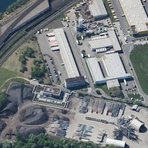
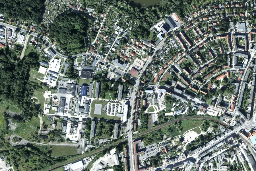
Orthophotos and oblique aerial images show networks, facilities, and areas in detail. They form the basis for documentation, planning, and permitting.

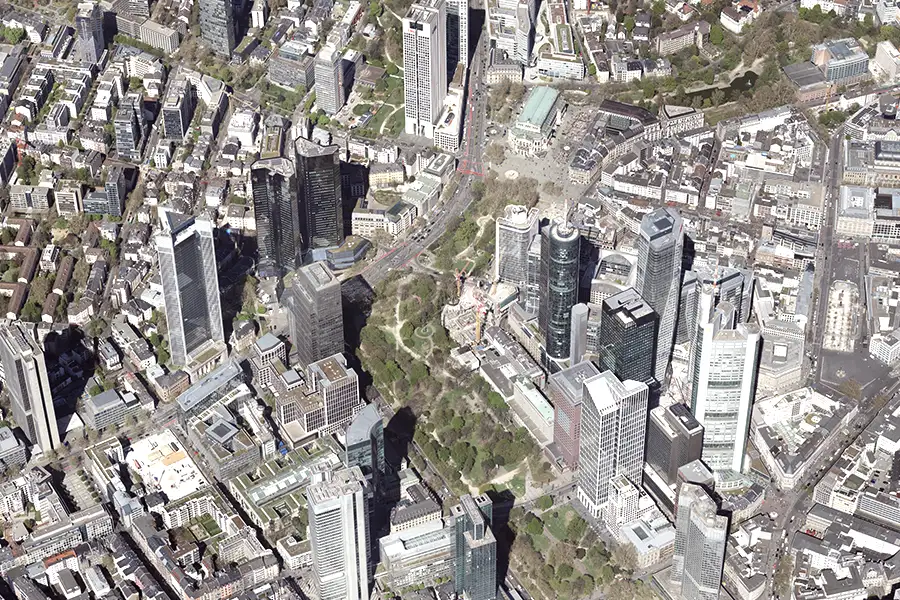
Realistic 3D twin models illustrate the environment of the network infrastructure and facilitate planning dialogues.
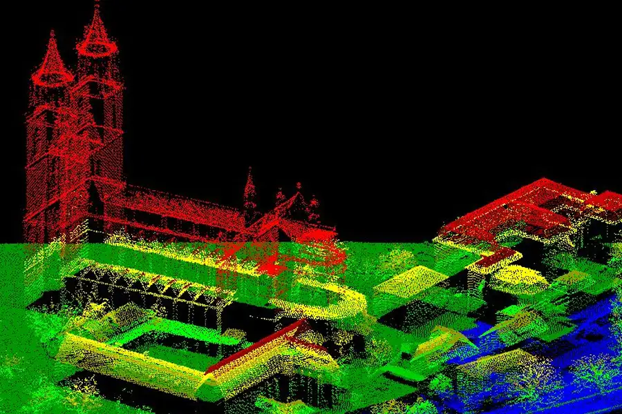
LiDAR point clouds provide high-density terrain and inventory data – ideal for distance analyses in the course of habitat management.
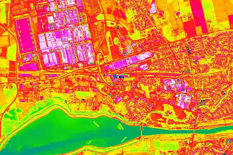
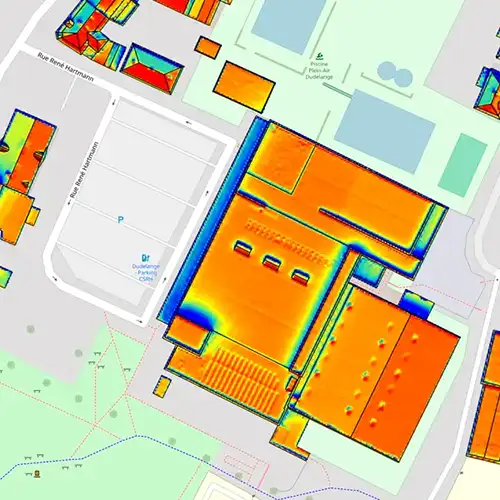
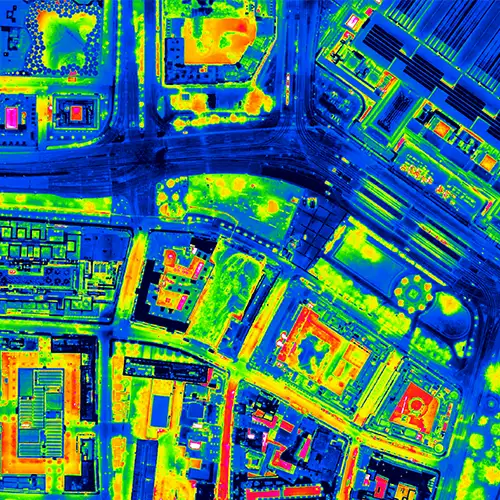
Thermographic images detect potential leaks early.
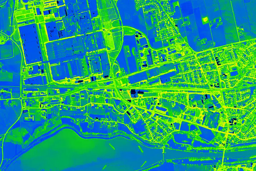
Trend and time series analyses from orthophotos and LiDAR detect deviations, predict maintenance needs and extend plant lifespan.
Thermal imaging detects leaks, overheating, and vegetation stress – for targeted repairs and network security.

Standard APIs (OGC, REST) and connectors integrate GeoFly data into GIS, CAD, BIM and SCADA – for automated processes and real-time control.

This is us: GeoFly. Since 2008, we have been surveying the Earth's surface – in over 20 countries across four continents. We are an interdisciplinary team of engineers, pilots, and data experts. Together, we plan, fly, and process the entire workflow – from flight planning and execution to data delivery. Our experience ranges from large-scale surveys for national mapping programs to pinpoint projects in highly complex infrastructure areas. We navigate expertly through diverse geographical, climatic, and regulatory conditions – with both a holistic perspective and meticulous attention to detail. Our own fleet of aircraft is more than just technology: it's our tool for maximum independence, ultimate flexibility, and uncompromising quality – anytime, anywhere. Whether cities, networks, landscapes, or buildings: we fly, plan, capture, and process data – for data that makes a difference. We make the invisible visible.
geofly © All rights reserved.
